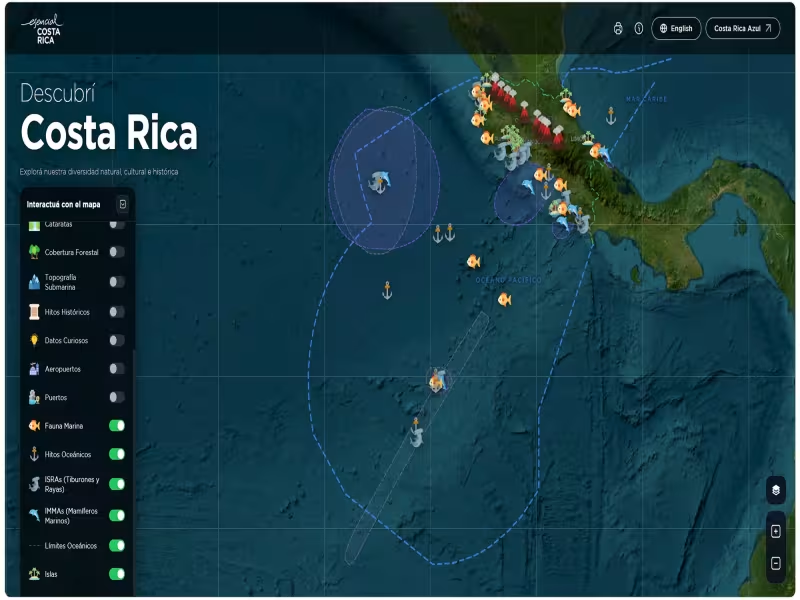
San José, Costa Rica – October 02, 2026 -- Costa Rica has launched a free digital platform called "Discover Costa Rica," an interactive map letting students, teachers, researchers, and tourists explore the country's geography, oceans, and culture online.
The platform maps national parks, volcanoes, and ocean territory
Developed by the Country Brand essential COSTA RICA with the Ministry of Foreign Affairs and Worship, the University of Costa Rica's Center for Research in Marine Sciences and Limnology (CIMAR-UCR), and the UCR School of Geography, the tool covers national parks, islands, waterfalls, and volcanoes alongside ecosystems, protected areas, and biodiversity data. It is available in both Spanish and English.
The map also highlights that Costa Rica's maritime territory makes up 92% of its total landmass, and includes historical milestones such as San José becoming the third city in the world and the first in Latin America to install electric public lighting, plus Costa Rica's early ban on sport hunting.
Academic researchers verified the content
CIMAR-UCR and the UCR School of Geography backed the platform's content with academic and scientific research, positioning it as a reference tool for education, tourism, and research alike. Adriana Acosta, Director of the Country Brand essential COSTA RICA, said the platform helps younger generations learn facts that shape the country's collective identity.
Dr. Eddy Gómez Ramírez, Director of CIMAR-UCR, said the platform's marine biodiversity data is grounded in scientific evidence and designed to spark curiosity about ocean life and conservation.
"Discover Costa Rica" is hosted on the essential COSTA RICA website and is paired with a related initiative, "Costa Rica Blue," which focuses on connecting Costa Ricans with the ocean and raising awareness of its importance.